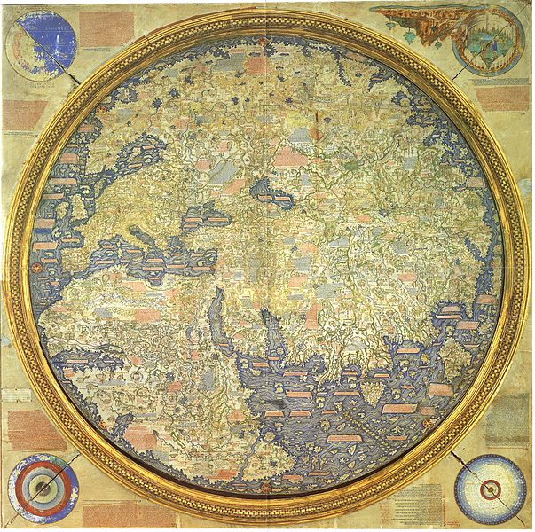
Early maps are very interesting and there’s a lot to say about them. How exciting a time it must have been as they were beginning to find out about the rest of the world. A great is example is the 1450 map by the Italian monk Fra Mauro. The map shows the amazing the work that Fra Mauro must have done over a long period of time, studying and talking to so many travelers and sea-voyagers and explorers. He put together an impressive and surprisingly complete map of the continents that was the most accurate the Europeans had seen at that time including for the first time the coasts of Europe, Africa, Asia, Japan and Taiwan (which is shown quite large).

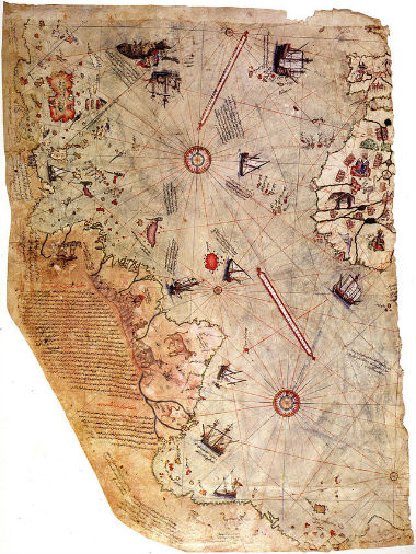
I’ve been reading about the explorations preceding the 1459 Fra Mauro map and the similar 1513 Piri Reis map. I was surprised when I noticed that explorer Vasco Da Gama didn’t reach India and return till 1498. Melchor Diaz didn’t round the tip of Africa till 1588. So Fra Mauro’s 1459 map had to be based entirely on earlier accounts, making the map all the more impressive.
One could say that the 15th century must have been an exciting time to live. Geographically, yes. But overall, of course in Europe, and probably Asia too, that wouldn’t have been a good time to live. I don’t know about Africa, Native American lands, or Polynesia during the 15th century and I guess little is known about what they were like before European arrival there. Of course nothing good can be said about the motives, morals or character of the Conquistadors, or most of the explorers, who were mostly after plunder. Columbus clearly expressed his desire for gold, and he killed a lot of Caribbean people in an effort to try to make them tell him where the gold was.
Who Were Christopher Columbus and Amerigo Vespucci?
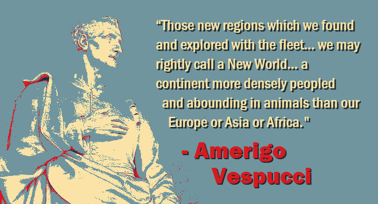
Of course Columbus didn’t know he found a new continent because he thought that he was in Asia. Amerigo Vespucci was the one who pointed out that it was a new continent. It’s therefore appropriate that the new continents were named for Vespucci. It was Waldseemüller’s world map that first labeled the new continent “America”, after Americus, the Latinization of Amerigo. That map resembled Ptolemy’s second projection, a projection-style that was widely being used in those days. Waldseemüller expanded Ptolemy’s map to accommodate the Americas.
Vespucci was a genuine navigator. Unlike Columbus, Vespucci knew where he was. In fact, Vespucci was one of the very few people who could find longitude before the introduction of the marine chronometer. It was by a method called “Lunars”. The position of the moon, with respect to the stars, was used to determine one’s longitude. But it required a lot of very complicated and laborious calculation, and only a few people could use it. Vespucci was one of those.
The early maps were impressive, especially the Fra Mauro map. But they weren’t impossible to make, they were just the results of clever and industrious 15th century map-makers.

See this link to see the Fra Mauro map in all its amazing detail.
Leave a Reply