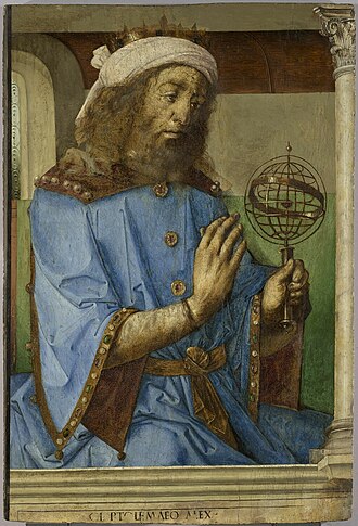
In my last article, I said that “maybe” equal-area maps go back a lot farther than 1500, but in truth I claim that there’s no “maybe” about it. It goes all the way back to Ptolomy who lived from 100 to 170 AD.
Ptolomy was a Greco-Roman mathematician, astronomer, astrologer, geographer, and music theorist who lived in Alexandria, Egypt during the era of the Five Good Emperors, considered by many to be the golden age of the Roman Empire. According to the famous 18th century historian Edward Gibbon:
“If a man were called to fix the period in the history of the world, during which the condition of the human race was most happy and prosperous, he would, without hesitation, name that which elapsed from the death of Domitian to the accession of Commodus.”
Ptolomy’s most influential works included his astronomical treatise known as the Almagest, an astrological treatise known as the Tetrábiblos, and another work Geography that was an exploration of maps and geography that would have a long lasting impact on the field. Ptolomy’s Geography and the maps he produced are much more important to the history of geography than many realize today.
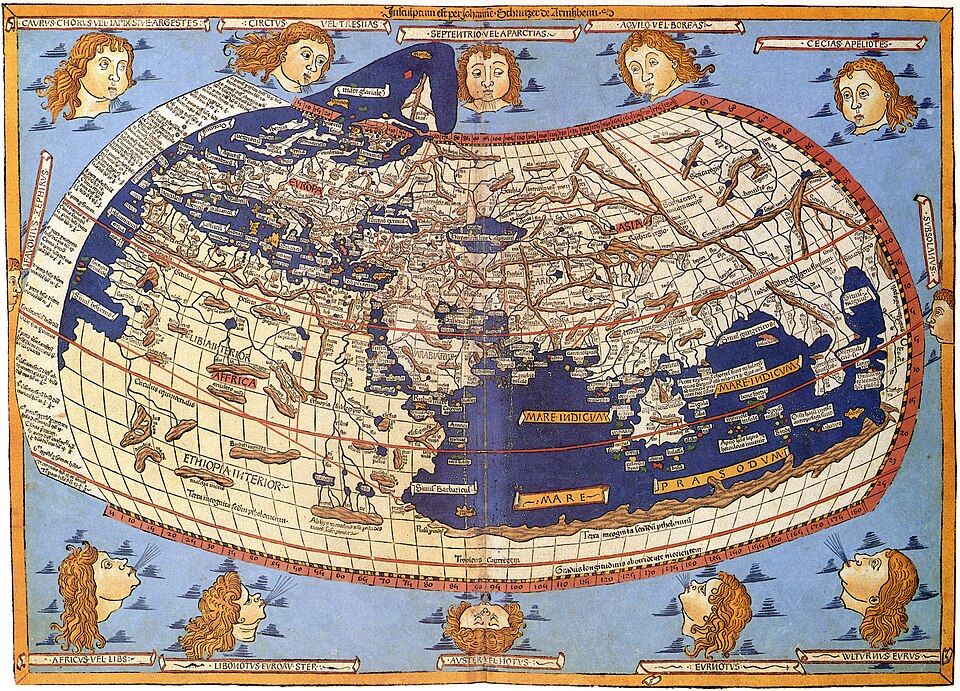
One of Ptolomy’s map-projections amounted to the Bonne Projection, named after Rigobert Bonne (1727–1795). The Bonne is like the equidistant conic projection, in representing the parallels as equally, truly, spaced concentric circles. The only difference was that, where Bonne divides each parallel truly, to determine where the meridians cross them, Ptolomy just approximated the meridians with circle-section curves.
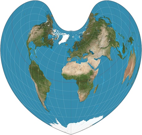
Bonne is an equal-area map. It’s the mid-latitude counterpart to Sinusoidal projection maps, a pseudocylindrical equal-area map, but it maps only one side of the equator. I’ll tell why I claim that it can’t be plausibly claimed that Ptolemy didn’t know about Sinusoidal. But first let me describe Sinusoidal’s simple, obvious & natural construction:
Sinusoidal consists of nothing more than drawing a globe’s parallels on paper, as straight parallel adjacent straight-lines, with the same lengths and spacing as on the globe. That’s it. That’s the Sinusoidal. Of course it goes without saying that (just as on the globe) the meridians cross any particular parallel at equally-spaced intervals. And so this procedure automatically places the meridians too. With the parallels’ accurate lengths & spacing, the Sinusoidal is automatically equal-area.
So why didn’t Ptolomy divide each parallel equally too? There’d be no point to. In Ptolomy’s day, no one had a way to determine longitude. So what would be the point in precisely positioning the longitudes of where the meridians cross the parallels?
So Ptolomy’s circle-approximation of the meridians was fully-justified. Ptolomy was approximating what Bonne would describe 1600 years later. He was using north-latitudes-Bonne instead of Sinusoidal, because the known world in Ptolomy’s time was all north of the equator. No one can plausibly claim that Sinusoidal wasn’t obvious to Ptolomy. If something were known about lands south of the equator, Ptolomy would have been glad to use the much simpler and more obvious Sinusoidal method.
Sinusoidal is simpler and more obvious than Bonne. Bonne’s parallels’ radii are calculated to agree with the average latitude of the mapped-region. So, I claim that the Sinusoidal goes back to Ptolomy, who used it in its all-north-of-the-equator version because that’s where all of the known world was.
One more thing about Sinusoidal maps: their disadvantage is that they relatively badly distort land near its periphery. It gives the impression that everything is being sucked up into a vacuum-cleaner at the North-Pole and could be said to be reminiscent of a stampede at a soccer-stadium. Point-min-scale and point-min/max-scale are low at peripheral longitudes.
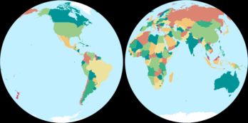
So, it could be said that one wouldn’t use 1-piece Sinusoidal maps unless they want to disfavor a longitudinal region (or, arguably, the whole longitudinally outer half of the Earth). But Sinusoidal is okay in its 2-part version, as with Mollweide maps, invented by German mathematician Karl Brandan Mollweide (1774 to 1825), that consist of two side-by side half-world maps. Such 2-piece maps are interrupted at longitudes 25 west and 155 east. One of the two maps is of Afro-Eurasia, the “World-Island”, and the other is of the Americas. 2-piece Sinusoidal maps are the diplomatically-feasible version of the simple natural obvious equal-area world map.
I should clarify that though I said something good about Sinusoidal in my last article, the Mollweide map is my favorite and my recommendation to replace the Mercator, Peters, and Equal-Earth maps that are widely used today. There are at least about 10 or 11 maps that I like (They’re all equal-area Pseudocylindricals world-maps). But Mollweide is my favorite and I consider it the best proposal.
I mention Sinusoidal, because we were talking about ancient history and it’s the most anciently-known equal-area world-map (even though it wasn’t actually used until there was something to map south of the equator). I like Sinusoidal’s stark-simplicity, obviousness and naturalness, but it doesn’t have Mollweide’s realism, beauty or big 130-year popularity.
Additionally, 2-piece Sinusoidal, though tolerable at latitude 30 continental-periphery (which is not outrageously out-of-the-question like 1-piece Sinusoidal), doesn’t have anywhere-near Mollweide’s point-min-scale there. It is around .8 for 1-piece Mollweide and only around .6 for 2-piece Sinusoidal. So, Sinusoidal’s advantage is really just that it has an easier explanation.
But Mollweide’s construction can easily be explained to anyone who would like to hear it and is willing to listen to it. Few people want to hear that, and that’s fine. But the construction is completely accessible to anyone and everyone if they want to hear it and are willing to listen to it. To make 2-piece Mollweide, one simply makes Mollweide out to 90 degrees east and west of the central-meridian for each of the two half-world maps. In the eastern piece, that central-meridian is at 65 east, in the middle of Afro-Eurasia.
Anyway, I’ve been looking at a detailed comparison between Equal-Earth maps and 2-piece Mollweide, the map illustrated at the top of my last article. 2-piece Mollweide resoundingly beats Equal-Earth, in every category, at every location I looked at. And I looked at (30,120), (0,0), & (60,0).
I should emphasize that though I claim that the Sinusoidal map must have been obvious to Ptolomy, given that he used the north-only counterpart of it (due to the absence of information about the South) and that his circle-approximation of the meridians makes perfect sense in the days when no-one knew their longitude, this leads to my claim that the Sinusoidal was anciently known and wasn’t a new idea in 1500 – we don’t hear any of that from cartographers, though I claim that it’s obvious.
It is my claim that it’s obvious that Ptolomy knew that the Sinusoidal would be the whole-world choice and would have used it if he’d had information about lands south of the equator.
The Equal-Earth map promoters think that they can get away with incorrect statements about the technical matters, such as when they claim that Mollweide projection maps distort peripheral countries too much. That technical misstatement is what they depend on to try to justify Equal-Earth. And a misstatement is what it is.
Leave a Reply